|
ANNIVERSARY POINT
BOAT HARBOUR
SOUTH CAVE
NORTH CAVE
MARY ANN COVE
CATHEDRAL ROCK
|
SPONSORS
accent on
 tasmania
|
follow updates on
| |
ROCKY CAPE NATIONAL PARK
North
West Coast
 |
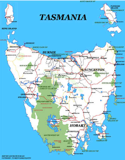
The well populated area of the North West Coast of
Tasmania is bounded on each side by the Narawntapu National Park to the east and
Rocky Cape National Park to the west. The Bass Highway passes south of
Rocky Cape National Park. There is vehicle access at both ends of the park
with the relatively large holiday resort town of Sisters Creek and nearby Boat Harbour Beach to the east.
|
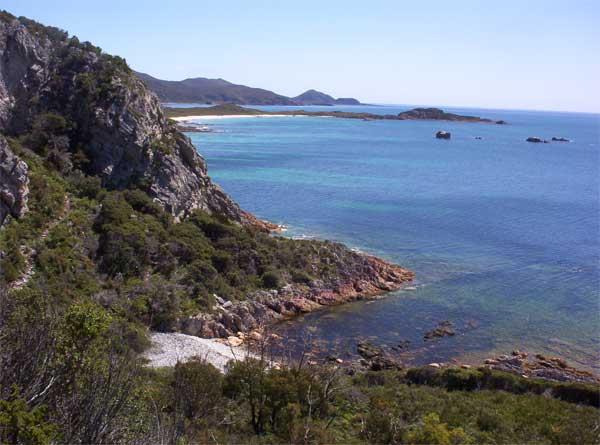
LEE ARCHER CAVE - about 45 minutes walk from Sisters
Beach. The cave is just beyond the track in the left of the picture. Further
west is Anniversary Point with Rocky Cape proper on the horizon.
|
|
|