|
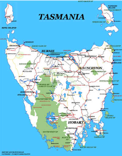
TASMANIA MAP GUIDE |
a pictorial guide to Tasmania's natural attractions |
|
|
|
 |


|
|
follow updates on
|
CAPE RAOUL The Tasman Peninsula The track to Cape Raoul is quite easy - just long. 5 - 6 hours return depending on your fitness level. As mentioned on the previous page, a very good vantage point can be reached after only about 30 or 40 minutes walk up a gentle incline. The view to the west is shown below.
Shipstern Bluff juts out to sea - middle left. Tunnel Bay is the next inlet further west.
Mt Raoul needs to be negotiated. It is harder going on the way back. The track drops sharply before reaching the 'plateau' of the peninsula.
Another superb view north where the track reaches the peninsula.
Half way across the peninsula looking back towards Brown Mt near Port Arthur. RIGHT: Mountain berry is in abundance on the walk. |